Topographical & Land Surveys
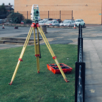
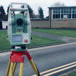
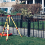
Our survey teams are trained to use Total Stations and Topographical equipment, this allows our surveyors to offer the benefits below…
- Accurately survey & plot irregular shapes.
- Accurately measure a building that has angled or curved walls.
- Level & height data across a site.
- The positioning of eves, ridges & high level bulkheads.
- High level elevations.
“…The main advantage of using a total station is that it enables the surveyor/draftsman to accurately survey & plot irregular shapes…”
Although total stations are mainly used by Topographical surveyors to accurately map land & geographic features externally they are particularly useful internally when a building has angled/curved walls & irregular shapes especially when there are no existing plans/drawings of a building or site.
“…Total stations can be used to provide level & height data across a site this is useful when positioning eves, ridges & high level bulkheads etc…”
Other applications are to survey high level elevations which would normally be beyond the surveyors reach without specialist equipment.
Contact us for more info...